Category Archives: Old articles

Articles from the old IMC website

Snowdonia early December

Mind and body pushed to the limits at altitude

Many thanks to Eddie for putting together this excellent meet.

The Christmas shopping streets of Ipswich, Stowmarket and Bury St. Edmonds were
left deserted; Blacks and Millets went into administration; the tea shop on the
corner of Museum Street saw no business at all, in fact global consumer
capitalism as we know it was more or less brought to its evil knees as the good
and simple folk of the Ipswich Mountaineering Club headed like a mighty legion
of post apocalyptic warriors for the hills of North Wales.

I think there was about twenty of us altogether and there wasn’t a bunk to be had
(apart from that one in the kitchen area attached to the wall by a single rusty
nail) at the Cwellyn Arms bunkhouse.

Martin, Sue, George and I went up on the Thursday night, ready for a full day on
the Friday. We did the classic N-S Tryfan scramble in cold “wintery” conditions.
That is to say there were the odd flurries of snow, but no need for axes and
crampons. Tryfan- the rock, the aspect is superb. There’s a hundred different
lines to choose, all for yourself, but always taking you higher. It’s sustained
without ever being committing. I love it. We all loved it. The four of us got
into Bwlch Tryfan about 2pm and decided not to attempt Bristly Ridge in what
little day light was left. We did slog up the scree slope to Glyder Fach, and
after a photo session on a cannon stone descended due east towards Llyn Caseg
Fraith and then due north into Cwm Tryfan and back to the car by about 4.30pm.
Having left at around 10.30am, you will note that we weren’t going at record
speed, but a very satisfying day indeed.

Saturday was the big one. An attempt on the country’s highest mountain via the
unconquered, some have said unconquerable south west ridge. Actually it’s a very
pleasant walk up the Rhyd Ddu Path straight out of the bunk house. Maddy, Al,
Adrian, Sue, Jon and I summited in time for lunch. The views at the top were
spectacular. At one point I was able to see as far Al eating a cheese sandwich
next to me. The cafe was closed and the train wasn’t running so we had to walk
down. We did so via the Ranger Path and took a detour up to Clogwyn to pay
homage to Johnny Dawes and the Indian Face. As we sat looking up at the
magnificent wall of granite, enjoying a flask of tea, Adrian suddenly dashed
towards the inscrutable blank face of Clogwyn Du’r Arddu. Al and I gave
desperate chase. We knew it was madness; not in this rain, not in those boots,
not in the failing light. He was 50 yards ahead, now 100, it was impossible,
around the lake- disappearing into the mist. At last Al and I fell exhausted at
the very foot of that towering E9, but it was too late. Adrian had already
touched the slab and blown the on-sight. [None of this actually happened.
Jeremy was obviously affected by the altitude. Thankfully, his mental condition
improved marginally once we got nearer to sea level. -Ed]

Sunday was an altogether gentler affair, along the Nantle Ridge- I suspect a
little trodden outpost of Snowdonia. From Rhyd Ddu head to the top of Y Garn and
the Ridge presents an obvious line stretching south-west. The visibility on
Sunday was poor, but occasionally the skies cleared to reveal views across
Caernarfon Bay. It rained and rained and then rained. But this did not deter
Nessie or her handlers. There are a two or three gentle broad ridges running
south east off the Nantlle Ridge. We took the first of these descending off Trum
y Ddysgl, but staying west of the woods until picking up the footpath at
Bwlch-y-ddwy-elor and heading north through the woods. It looked easy enough to
get lost in there, but happily Hannah knew the way. [Eddie and I did get
lost in there the previous year. – Ed]
This was a great hill walk, but I
think if you go further along Nanttle Ridge it does get more serious.
[Actually, the party had done the scrambling section. The rest is easy walking.
Arguably one shouldn’t return to high altitude so soon. – Ed]

Hot Rock – Sicily 2011

Suffolk climbers migrate south for the winter

You know how it goes – the UK climbing season is drawing to a close for us fair
weather dudes so thoughts turn towards getting some sun on yer back with the
prospect of a bit of bolt clipping thrown in for good measure.

And so it went, Steve C started mumblings of a trip to Turkey or South of France
(anywhere but Spain apparently!) and was anyone interested. I had read a recent
article about some good looking cliffs at San Vito Lo Capo in NW Sicily so threw
that into the melting pot as an option. After a healthy(?) dose of good old IMC
faffing we eventually decided Sicily it was to be for Steve, Clare, Christina
and yours truly. After all, it’s a big ole island with climbing in areas other
than San Vito if it was crap there.

Then the jungle drums started a-rattling and before we knew it we were looking
for accommodation to suit 11 people with only one couple included – i.e. a BIG
place with lots of beds! Much cyber time later and Mr C, with Christina’s help,
had unearthed the very place, secured the booking and obtained commitment from
all interested parties. The game was on!

The usual rigmarole ensued; booking flights – you know the thing, “surely there
is a better deal than feathering Mr O’Leary’s nest”, but unfortunately not –
hire cars, transport to and parking at UK airport, packing, weighing and
re-packing bags, divvying up gear etc, etc.

But, finally the day arrived

So there we were, 11 bleary eyed climbers looking for strong coffee in Stansted
airport at early O’clock am on Saturday 8th October 2011. On arrival at Palermo,
Steve, Clare, Jiehan & Kristina got their hire car and headed off as advance
guard while I, Christina, Johnboy & Karen held back for Tom, Ali & Emma to get
their car sorted out. San Vito is about 1.25 hours from Palermo airport and is
even signposted along the way!

Much of the scenery is pretty scrubby and there is a general feeling of being
unspoilt by excessive tourism. I had this feeling throughout the week, but
couldn’t help wondering how long it will last.

The good thing about Steve going ahead is he could work out how to get to the
villa for the rest of us! Also, we all had to complete forms with name, age, UK
address, passport numbers and stuff to register our visit with the local
Polizia, so it was necessary for the villa owner to meet us on arrival. The
communication was interesting – us with a smattering of pigeon Italian and her
with slightly more lucid pigeon English! Eventually all was done, rooms chosen
and it was time to head down town for some lunch.

Down town took less than 10 minutes in the car, but 30 minutes trying to decide
where it was safe to park without risking having the car towed away! While
wandering around looking for a suitable eatery we discovered that this was San
Vito’s climbing festival weekend, so gear-fondling opportunities abounded! The
only purchases made however were of a fantastic fold out topo for all the cliffs
in San Vito showing a whole stash of development since any of the guide books we
had purchased in the UK were published (and about 1/3rd of the price).

Steve’s team had got into town ahead of the other 2 cars (a theme for the week!)
and were ready to go off and find some climbing while we sat and finished our
lunch. “Is that a brass band I can hear” someone said as a funeral procession
rounded the corner. It was a definite Don Corleone moment!

Tom, Ali, Emma, Johnboy & Karen all decided to hit the rock after lunch too, but
Christina and I opted for a more genteel past time – shopping!

“Yeah, yeah this is all very well, but what of the climbing?” I hear you cry.
Patience, dear reader, patience.

Come the evening, the rest of the assembled party went across the road to the
local pizzeria for dinner while C and I knocked up a tasty treat back at the
villa thinking we would wander over there later in the week. This, however, was
not to be as it appeared not to open for the rest of the time we were there!
Still, much fun was had with communal cooking, eating and general evening
antics.

Now, let’s get to the interesting stuff shall we?

Well actually I won’t recount every climb on every day with a blow by blow
account, but here are some highlights and personal favourite moments.

The coastal cliffs of San Vito Lo Capo run for about 5-6km and range from short
8m routes to 50m 2 pitchers – all bolted and with route names painted on the
rock at frequent intervals to make it impossible not to know where you are. Some
traditional purists might suggest this is cheating, but it certainly helps when
you’ve only got 6 days to explore a new venue. In addition to the physical
range, there are routes from grade 2 (yes, grade 2!) up to high 7’s/low 8’s – so
plenty for everyone.

One day C and I were bimbling around in one of the sectors when a local turned
up, did a couple of quick routes (not on our recently purchased topo) then set
his top rope up, whipped out his power tool and proceeded to start drilling
holes. We could see at least two new routes he was creating, so our new topo is
already out of date!

The rock is typical Mediterranean limestone with occasional areas of smoother
flowstone that gives a slightly different climbing experience. Karen
unfortunately had to return to Blighty on the Wednesday so Steve, Clare, Jiehan
& Kristina took her to the airport early doors and had a day climbing on some
cliffs above Palermo. Apparently this area had more of the flowstone type rock
than San Vito.
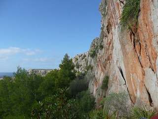

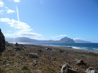
The Cliffs

View from the cliffs
The Cliffs (click on any picture for larger image) View from the cliffs

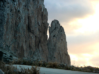
Just inland (by only 5 minutes!) is a big old lump of rock called Monte Monaco.
In front of this is a smaller pinnacle by the name of Pizzo Monaco. There are
several routes described in the guide book on both bits of rock but one that
took my eye during the pre-trip reading was the 6-7 pitch Pace Di Chiostro
graded at 5a overall on Pizzo Monaco, with trad gear backed up by bolted crux
sections and bolted belays. What a fantastic route! Christina and I took
ourselves off to have a play (after Steve & Clare had sussed it out and supplied
some beta). Many of the pitches were 35m-40m long which made communication in
the wind and without walkie-talkies (something had to be sacrificed in the
packing) tricky leading us to resort to the ‘tug on the rope’ system! And the
fun didn’t stop there – the abseil off the back of Pizzo Monaco was a 2 stage
affair and it felt like you were about to walk off the edge to find the first ab
station. Just to add an extra frisson of excitement, the wind kept blowing the
ropes into the fissure down the corner we were abseiling down and causing it to
get stuck on seemingly micro-protuberances of sharp limestone! But, all in all a
brilliant day’s climbing. Oh, other than the lucky miss at lunch break. There
was a German couple (lots of Germans there) nipping at our heels about half way
up so we decided to chill, have some food and generally soak up the atmosphere
to let them climb past. So as not to get in their way, we moved round the ledge
to under a bulge a few metres away from the belay point. Just as well it was
under a bulge, the leader set off up the diedre for the step left out on to the
face. The next thing we knew there was a shout and a whoosh as a lump of rock
about 0.5m square came hurtling down missing our ledge by cms (thanks to the
bulge above) before continuing on its inevitable, gravity fuelled, journey –
phew! After that we both hurriedly re-installed our helmets – although I doubt a
hard hat would have made any difference if that had bounced off your bonce!
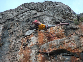

Comedy Moment

Pizzo Monaco
Comedy Moment Pizzo Monaco

Best single pitch sport route of the week? The 6a Oltre Manica in Sector
Calamancina 1. There was just something pure about this 28m open corner and face
route. The 6a moves were wonderfully technical and flowing with a little bit of
thought required on route finding and a pleasant bit of exposure near the top –
perfect. Plus the added bonus of only one other pair climbing in the whole
Sector when we did it.

The most unlikely route? The grade 3 in Sector Salinella Pineta. Seemingly
ridiculous moves out of a hollow in the foot of the cliff –but actually it’s
dead easy! There’s also a grade 4 starting in the cave at Sector Torre Isulidda
and traversing round just under the roof of the cave to the lower off – crazy!

Best spectator moment? Jiehan’s horizontal body jam and bolt clipping manoeuvre
on one of the more exciting 6a+ routes – an absolute comedy gem!

Most concerning locals? The ‘horse people’ as we came to call them. A community –
probably of Gypsy/Romany descent and most likely operating in an off-grid
economy – riding around in their carts and galloping (yes, galloping) their
horses along the tarmac road using hardly a saddle and only a rope halter. The
poor horse’s legs were splaying all over the shop and it looked as if it would
take a tumble at any moment. Not to mention the sparks from its shoes. Some of
these guys were also seen sitting on their horses outside corner cafés drinking
espresso, talking and generally gesticulating in an Italian manner.

To get a flavour of what the climbing at San Vito is like just click here. The
‘new’ routes are a bit out of date, but the pictures are worth a look.

How to get there?

As mentioned above, Ryanair fly to Palermo from Stansted. I think Sleezy Jet fly
to Trapani but I don’t know from which airport, certainly not Stansted.

Where to stay?

The usual internet search brings up a plentiful supply of apartments and villas
in San Vito itself and the surrounding area. But, if we were to go back, the
first choice would be El Bahira. If you can manage it on the meagre baggage
allowance allowed by Cheap Flights Ltd, you can camp here or, with less hassle,
rent one of the in-situ mobile homes or apartments – they even do a special
climbers’ rate between October and March. An added bonus if you stay here is
that every sector (other than Monte Monaco) is within walking distance, in fact
you will be quite literally under the climbing as Sectors El Bahira & Campeggio
are directly behind the site.

So, there you have it. I started this article thinking I would just do a few
words following Adrian’s last plea for copy, but I seem to have rambled on for 3
pages – an indication of how good we thought the place was. And we didn’t even
get to explore the area around Mt Etna and the E/SE coasts!


Bluff your way in climbing

Part zero of the IMC essential skills series

It’s often been said that being a beginner climber is tough – you’ve got no credibility, no-one wants to climb with you, and none of the IMC cliques will let you in and invite you down the pub. Of course it’s totally unfair as the likelihood is that you can burn off 90% of the club members at the wall and you’re a star in the making, so here’s my solution to the problem….

A little knowledge goes a long way if you’re careful how you use it, so here’s a quick guide to some techniques for impressing the gullible in the club (don’t worry, there’s plenty of us), establishing almost instant cred and impressing all and sundry with your levels of competence and experience.

Firstly pick your victim – there’s only one real rule here: avoid Martin Hore. All the bluffing techniques I’m about to impart are likely to fail in the face of many years’ experience on the rock and a photographic memory – that and the fact that he’s basically an ex-teacher and everyone knows that they’ve got a sixth sense for detecting little white lies….

Crags:

It’s important to know at least a handful of crags but if you choose carefully you really need only to memorise half a dozen key points and you can pass as someone with years of experience.

The first thing to do is to establish your ‘specialty crag’ –Just like on Mastermind this is the one you’ll claim to be an ‘expert’ on and you’ll have to do a tiny bit of homework for this. Steal a guidebook from some unsuspecting member whilst they’re not looking and flick through the crag guide looking for key words such as ‘industrial’, ‘unpopular’ – basically you’re looking for something small, esoteric (a handy term to remember), and preferably falling down. Stars are a real-no-no here – no more than 2 on the whole crag. You’re looking for somewhere that no one has been to or would ever want to go to in a million years. Your line will be that you picked it because you were recommended it by a friend or perhaps by an article on the Internet.

Classic choices would be Stannington Ruffs or something from the ‘connoisseurs crags’ section of the Yorkshire guidebook. Get a rough idea of where it is – phrases like ‘about 20 miles West of Sheffield’ or ‘Just East of Manchester’ are suitably vague for peak district crags. If your memory is excellent you can then memorise half a dozen routes that you can claim to have done but there’s really no need as I shall shortly explain.

In addition to your specialty crag it’s worth being able to bluff your way in one or two more popular ones. You don’t need much here – the trick with these crags is to choose those that everyone’s been to and get the victim talking about routes they’ve done rather than the ones you’ve invented – really this is like taking candy from a baby as all climbers are suckers for talking about their own routes and just a few encouraging noises and useful phrases can keep the attention off the details of your bluff. The obvious choice here is Stanage (pr. Stannidge). Phrases like ‘That’s at the popular end isn’t it?’ and ‘I hear that’s tough for the grade’ will be your stock in trade here to keep the conversation flowing.

Routes:

When choosing routes to have claimed to have done, check the guidebook and always pick routes in the less popular areas of the crag. Selecting those with the words ‘traditional’, ‘squirm’ or ‘thrutch’ in the description will reduce the chances of anyone having done them. As a bonus you can claim to be climbing in the footsteps of the climbing forefathers – Don’t lay it on too thick or you’ll get pointed at one of this sort of route when you get out on the rock with words
like ‘you like this sort of thing, off you go and I’ll see you at the top to help with the belay’. You don’t want that.

As I mentioned, you don’t actually have to memorise any actual routes at all. Climbers are a pretty unimaginative lot, and never more so than when naming routes. So here’s a handy crib table that should help out when lost for the name of a route you can claim to have done.

Puttrell’s Chimney Variant
Green Crack Direct
Leaning Gully Indirect
Straight Route Eliminate
Chockstone buttress
Heather wall
Left/Right
Holly

Don’t get too cocky here. Claiming to have done ‘Turquoise zigzag wall indirect’ is likely to cause raised eyebrows.

So there you are: instant crag-cred without the hard work.

Old Men On Stoer

An account of a climb on the Original Route, Old Man of Stoer

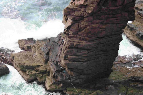
Some of my walking buddies had organised a walking trip to the Assynt region of North West Scotland for our Spring 2011 walking weekend. As I usually do, I had a quick look on ‘Find a Crag’ on UKClimbing, and was very pleased to find the Old Man of Stoer – a sea stack – only a few miles from where we would be staying. The Old Man had not been a particular thing I had planned to climb, but the opportunity seemed too good to miss. A quick bit of research showed that the original route up the Old Man, at a 4 pitch VS climb seemed do-able and enough of a climbing challenge, and I managed to persuade Keith (more a walker than a climber but with all the necessary gear) to join me.

More research showed that as the Old Man was not attached to land, then the logistics of getting across to it could be more of a challenge. Either we would have to set up a Tyrolean traverse or, according to some on-line guides, it was possible to “rock hop” across to the Old Man from the north on spring low tides, and as luck would have it, the day we arrived would be just right. So as not to get too much in the way of the walking, the plan was to climb the day we arrived, we’d fly into Inverness airport about 11:00, drive the hire car as fast as legally possible across to Stoer, walk out to the Old Man and we should arrive there about an hour before low tide so that we could ‘rock hop’ across and have enough time to set up a Tyrolean for the return.


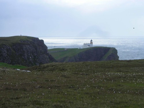
Stoer lighthouse

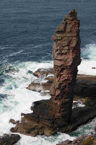
Old Man of Stoer
Stoer Lighthouse (click on any image to view in Flickr) Old Man of Stoer

The weather forecast the week before the trip did not look promising – gusts to almost 50 mph and rain. I don’t mind climbing in the rain, but I don’t particularly like climbing in high winds, especially on a rock pinnacle in the middle of the sea (well, almost). But luckily the forecast got a bit better and the day before the forecast was for no rain and winds “only” 28mph, so it looked like it on.

So we set off early from Ipswich to Luton Airport and flew up to Inverness in clear blue skies and lovely weather, but the moment we touched down in Inverness it started to rain! This didn’t bode well, but as we drove across Scotland, as fast as we could to make the tide, we didn’t get any more rain. But as we got to the car park at the Stoer lighthouse, it was still very windy. I bought a tea from the van in the car park and the wind was so strong that as I tried to drink the tea the wind blowing over it splashed the tea all over my face. The lady selling the tea made a comment that in all the time she’d been selling tea in the car park (about 5-6 years) she’d never seen anyone try to climb the Old Man in as such bad conditions, and even when the conditions were better over half the parties turn back because of the roughness of the sea. (she obviously thought we were mad, and she started to sow a few more seeds of doubt in my mind as well).

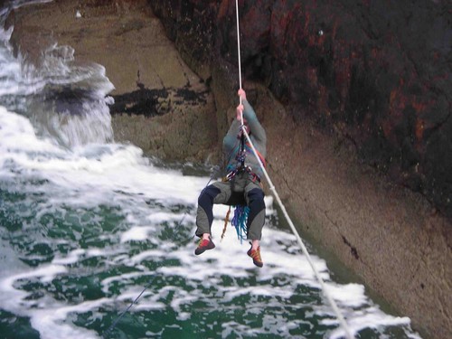
We marched the 2 miles to the Old Man as fast as we could in order to have enough time as possible to ‘rock hop’ across. Unfortunately we failed dismally to find the way across from the north and so we took the more well used path down to the south to where there was a Tyrolean left by a previous party. Now, we had intended to set up our own Tyrolean, but on inspection the one left there looked solid, and whilst we couldn’t see the anchors on the far side, we decided to test it, and then I risked a crossing on it with our rope used as a safety line.


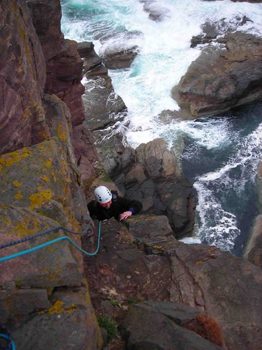
Pitch 1
Pitch 1

When I was on the other side, the anchors looked pretty good there as well, so Keith followed me over and we could then start the climbing with waves breaking all around us.

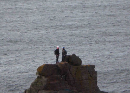
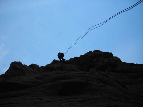
I described the climb on one of the Club winter talk nights and I’m not going to go into the detail again here (though i’ll appily discuss with anyone over a beer), but I’ll leave you with a few pictures taken from the mainland at the start of our climb by our friends, and ones taken at the end of the climb by a passing couple who kindly left a note on our car with their email address.

All in all it was a great climb, made to feel very adventurous because of the weather, and yet reasonably accessible – Keith remarked on the way back to the car that we had enough time to drive back to Inverness and get a plane home, thereby doing the whole thing in a day trip from Ipswich! However, sense prevailed and we headed to Loch Inver where we met up with our friends for a big meal and few well deserved beers !


Last pitch

Top of Last pitch
Last Pitch Top of Last Pitch

On Top
On Top

1st Abseil
1st Abseil

Traversing back
Traversing back

Rodings Rally Report

A dark tale

Kearton Rees – March 2011

A few months prior to the first phase of the mini-Winter at the end of November,
the Outdoor Group started planning a team to participate in the Rodings Rally,
an overnight orienteering event organised by the Epping Outdoor Group
(www.efog.org.uk/) and held in Epping Forest, north of London. By the week of
the event the team had changed several times and, at the last minute, even the
organiser himself had to drop out. Even then it was touch and go whether we
would be able to get there due to the snow, but finally the weather started to
thaw and a team of three, Andy, Rachael & I, set off hopefully. Luckily the
conditions around the north of the M25 were better than Ipswich. Our allotted
start time was 2215 so we first had a good meal in a local pub.

The format of the rally is that orienteering maps are supplied in advance (These
are 1:10,000 and use special orienteering symbols which provide much greater
information on the ground cover, enabling experienced orienteerers to decide
whether going around an area will be quicker than going across it.) A set of
checkpoints, tents in this case, is provided at the start (5 or 10 depending on
which course you opt to do) which you must plot, visit in a defined order and
then get to the finish, all within a set time. Although a hundred teams had
registered for the event, only about seventy turned up on the day.

After kitting up for a cold, clear night (it got to -7'C before dawn) we checked
in, picked up our route details and our clock was started. We also bought some
Romer scales on sale there. These are transparent overlays with each map grid
square (1 km) broken into a 10 x 10 grid which is helpful for estimating
distances. On examining the route details we found that we had to decipher a
number of puzzles to find the checkpoint locations first, so it was back to the
car. The puzzles were in two forms, three possible grid references were provided
plus either an anagram describing the place or a visual Rebus-style puzzle.

We spent nearly two hours solving the clues and plotting the checkpoint locations
and, crucially it transpired, planning our routes between them at both a general
level (macro navigation) and a detailed level from a local reference point when
we got close (micro navigation). We finally set off just before midnight. The
bonus of the recent cold weather was that, despite the odd icy puddle, what
would normally have been quite muddy ground was, for the most part, quite firm.
When we got close to the first (and only illuminated) checkpoint we found many
other teams walking or running in various directions, but none in the direction
we were going. After much puzzling over which path crossing was our reference
point we eventually headed into the trees and searched methodically, but in
vain, for the tent.

After multiple unsuccessful sweeps we eventually gave up and headed off to
checkpoint two. This proved somewhat easier and showed us exactly what we were
looking for. A small, low, dark two-person tent with a single small sign showing
the checkpoint number outside the door. Very easy to miss in the dark from even
a few metres. Checkpoint three was found similarly. Heading on to Checkpoint 4
we paced out a set distance along one of the paths and then turned into the
woods again. A lot of teams were there searching for this one, many about 200m
to our right. After about 15 mins with no success, we decided to go back to the
path and work our way in form a different reference point. As it happened, this
brought us back to exactly the same point, giving us lots of confidence in the
accuracy of our pacing. After about another 10 mins we found it and headed off
again.

The next checkpoint was roughly at the centre of the forest, and on the way a
refreshment post had been provided. Hot drinks, burgers and Mars bars were
available and welcome on the cold night. At Checkpoint 3 we had met a team of
four blokes that we'd seen near the previous one. After Checkpoint 4 they had
hared off along the track as soon as we got to the nearest path, but somehow
managed to arrive at the refreshment post after us.

Checkpoint 5 was due west of the refreshment post. We tried to follow as direct a
route on that bearing, but got separated with Andy and Rachel getting closer to
one of the forest paths. A lot of other teams were looking for it which lead to
another problem arising. Entry regulations required everyone to carry a
reflective vest to wear when walking on the roads, but as most were similar, it
was much harder to keep track of team colleagues amongst them. Eventually we
found each other and, with just a couple of search sweeps, found the tent –
ahead of the other team.

The next target, Checkpoint 6, required heading directly through thickening
woods. This is where we were grateful for the firmer ground. After clearing the
wood we followed one of the main roads that criss-cross the forest to reach our
reference point. On route we again caught up with the other team who were about
to head into the trees from the road. We however continued along the road, then
down a path along side a stream. This gave us a much closer reference point from
which to start our micro navigation, and indeed we had found the checkpoint and
were well on our way back before we saw that the others had decided to follow
our route.

Now for Checkpoint 7. This involved a long walk along roads and tracks. It was
part way along the road that I casually looked at my watch and saw that it was
0740, 20 mins before those providing breakfast were due to stop. Somewher ewe
had lost two hours! So, about turn and quick march.

We arrived at five to eight to be told that they keep serving beyond 0800 for
those who are late finishing. While we ate breakfast, the organisers processed
our card. Five out of six checkpoints from a target of ten – how would we do? As
it happened, we had remembered the physically and psychologically important
end-time for breakfast but not, unfortunately, the end of our allotted
navigation time. We had over run that by about 20 mins and so incurred a major
penalty. In fact we were now last, with only a few more teams to arrive.

After breakfast and a short rest we headed back to the car, where the thermometer
told us that it was now -6.5'C. During the drive back it gradually got warmer
and was a balmy -1.5'C at Ipswich. On reflection, the cold weather had helped us
because if it had been warmer, the ground would have been very muddy and making
the event much harder

The formal results were released a week or so later to allow for checking and our
position had not improved. Two positive things came out of it for me: my pacing
of distance proved reasonably accurate and our approach of macro then micro
navigation worked well as we were consistently reached checkpoints before the
four-man team – despite moving more slowly. I'm therefore looking forward to
improving on our position at next year's event. As the song goes: “The only way
is up”.

Banff Film Festival

Shown at the Norwich Playhouse Theatre

Kearton Rees – March 2011

Every year in the Rocky Mountain town of Banff, Alberta, Canada, a festival is
held to celebrate new films on outdoor topics and to pick the best in a variety
of categories. After the festival finishes, teams go on tour around the world
showing subsets of that year’s best films in a variety of locations including
this year, for the first time, Norwich.

Last Saturday, despite the best efforts of National Rail and National Express, a
small contingent from the IMC plus some friends from the Outdoor Group met at
the very pleasant Playhouse Theatre on the riverside to see this year’s
offerings.

The showing started with “The Swiss Machine”, about Swiss mountaineer Ueli Steck
who specialises in rapid solo ascents. It followed him in the Alps and then on
several climbs in Yosemite including the famous El Capitan. The American who
partnered him on the latter found it hard to believe the pace at which he
climbed. He likened him to a Swiss watch that just keeps going at a steady pace
without ever stopping.

Back in Europe, the first solo attempt at the Eiger was made by Reinhold Messner
in 10 hours. Then he heard that another climber had set a record for a solo
climb of the North Face of the Eiger of about 4 hours. Of course he had to have
a go and managed to complete it in about 3 hours 50 mins. As if to diminish this
achievement he immediately said that the thought that wasn’t the limit! After
undertaking a long and intensive, personally designed fitness and preparation
programme he set off again. Ueli is a soloist so, as a matter of principle, he
avoided any of the fixed ropes on the mountain. The most critical being the
ropes across the Hinterstoisser Traverse, where a large group of experienced
Austrians died in one of the initial attempts that found what has now become the
most commonly used ascent route. After ascending like lightning above drops of
2-3000 metres he reached the ridge and then literally ran along it to the peak
where he took a quick swig of water. At that point I half expected him to pull
out a parachute and take the quickest route down! His ascent time – two hours
and forty seven minutes!

The then followed the winner of the Short Film Award, “The Longest Way”. This
illustrated the journey of a German adventurer on a walk from Beijing back to
Germany. It took the form of a rapid series of photos and short video clips
showing his face and whoever he happened to meet at different points on his
journey and, in one corner, the mileage from the start. The main effect was to
show how his facial hair had increased as he progressed. The other interesting
point was the little bicycle-wheeled trailer he had to support his walk across
the desert areas. Much easier than a rucksack.

The longest, and in my opinion the best, of the films was “Crossing the Ditch”.
The story of two young Australians who decided, to paddle a canoe across the
Tasman Sea to New Zealand.

The first half of the film covered their preparations. Having no canoeing
experience they consulted a variety of experts in preparation. They had a canoe
designed by a British chap who had designed one that had crossed the Atlantic.
It was made of a synthetic material that only showed minor dents when hit by a
lump hammer! The film covered both their and their families’ feelings on the
topic. This was especially poignant when an experienced canoeist, whom they had
contacted earlier for advice, set out before them on the same journey, solo, in
a modified standard canoe and disappeared from his canoe when nearing New
Zealand.

The second half of the film covered the canoe journey itself, from excellent
progress on smooth seas in the first two weeks to getting stuck in a circular
current system for eleven days, storms, sharks and a freak encounter with yacht
when half way across and their reception in New Zealand. This film focussed more
on the emotional and motivational side of the adventure than many of the others.
Covering their loss of confidence when on half rations due to the delay caused
by the circular current and from the sea sickness that one suffered from but
thought he had found a way to overcome, returned unexpectedly, to worries when
their parachute anchor cable wrapped itself around their rudder at night in a
storm.

“Azadi Freedom” covered the state of skiing in Kashmir province from the point of
view of someone who wanted to become its first ski guide, even during the wars.
It brings out the part that skiing is playing in rebuilding the tourism industry
there.

“Dream Result”, the second canoeing film shown, covered the exploits of a set of
top athletes and their friends white-water kayaking and their attempts to set
the world record waterfall drop on rivers in Norway, US and Argentina. After
seeing both of these films, I didn’t feel so bad about missing Andy’s canoeing
session in Hadleigh to attend the show.

Finally there were two shorter films:- “Life cycles” involved mountain biking and
trick cycling with an impressive fast ride along a steep forest track with
partially blind jumps, followed by trick cycling and jumping on a farm in the
grain belt of the US. In contrast “Parking Garage” looked a the lighter side of
mountaineering with a formidable multi-day ascent of the highest multi-story car
park in town in the style of the Monty Python team’s ascent of Uxbridge High
Road, but with a bit more height.

Lastly, because the show had run on longer than we and they had expected, we were
left with only 15 mins to run across the town, dodging many nightclub queues, to
get to the station for the last train home. Well that’s my exercise for the
week. If you get a chance to see the Banff Film Festival, do so.

Learning To Climb Again

An Introduction to Winter Lead Climbing at Glenmore Lodge

I wish that I hadn’t taken the overnight coach I thought on the walk into Coire an t-Sneachda. Maybe in hindsight it wasn’t such a good idea to go by a method of transport that guarantees an interrupted, uncomfortable night without the benefit of anasthetic. Maybe going for a week of winter climbing in the Cairngorms with a niggling ankle injury wasn’t the greatest of ideas either.

Pushing those thoughts aside I pushed on diagonally up the snow slope, unsteadily trying to keep pace without slipping or impaling myself on my own crampons. A few helpful tips on how to improve my footwork from our instructor (Mike) later and I’d made it to the beginning of the day.

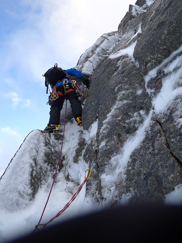
Still a little shaken, I followed Mike up Hidden Chimney Direct Start. Having never climbed anything harder than grade II before, jumping straight into grade IV was a bit of a shock to the system! Some inventive moves with my borrowed axes were needed – yes you can jam your hammer into a crack, but only if you can live with having the pick pointing straight at you when you make the next move. First pitch over without mishap my fellow instructee, also confusingly called Mike, lead the much easier second pitch. As I was standing around in the cold for the duration, I started the lengthy process of extracting a flapjack from its wrapper whilst wearing mittens. An eternity later I took my first bite: seconds later a lump of ice knocked it straight out of my hand.

James belaying on the Haston Line

Finally – time to climb again. I moved up to where Mike and Mike were waiting before leading through to the top, Mike (the instructor) happly soloing ahead and either finding or placing gear up ahead. As we got further up the protection got even sparser so that as I traversed below the cornice that signalled the end the plan became: just don’t fall off. As I cleared the cornice I came to an abrupt halt as I reached the end of the rope. Luckily Mike had the other rope and was able to set up a snow bollard and a bucket seat as I struggled to move into a safer position. Some revision on how to body belay later, Mike made it to the top.

After an action-packed first day, we followed it up the next day with a long walk through Charlamain Gap to Lurcher’s Crag. The 1.5hr walk in took a whole 2.5hrs but when we got to the base of North Gully it was worth it as there was loads of lovely water ice. As I’d got a different pair of axes out of stores I was enjoying the benefits of clipper leashes (no axes dangling from my wrists when trying to place protection for example). We even had some sunshine! After walking out in the dark we made it back to the lodge in time to bring the remains of the scheduled tea and cake into the evening lecture.

Sunshine from lurcher's crag

Lectures in the evening were all on useful topics like how to avoid getting avalanched, how to navigate when you can’t see, and what to do if you fail to avoid being avalanched. At the end of each lecture it was easy to see who was on a climbing course as we were the ones having difficulty unfolding ourselves afterwards.

Wednesday we climbed with the other group on the leading course (to make things less confusing both fellow students were called David), and we spend a pleasent day scittering around on a mainly rock route and getting used to placing our own protection. Now for those of you who’ve only climbed in summer – it’s a bit more involved that just finding the right sized nut to fit in the likely looking crack. First step is to clear away the snow in order to find the crack in the first place. Next you have to scrape the ice away from inside the crack. Then you try to place a #3 nut – it fits! Not so fast – lets just ckeck that all the ice has been removed. Some more scraping and you find out that crack is actually large enough for a #6! Now to make sure that it’s well seated – you hit it with your pick until the nut is completely misshapen. Rinse and repeat.

Also David (but not the same one as before)

By Thursday there had been a bit of a thaw. So as we climbed up Goat Track Gully there was meltwater in addition to the rain streaming down the rock, down the ropes and then onto the belayer. Valuable lessons were learnt like:

  • waterproof gloves aren’t;
  • belay jackets only work if you wear them;
  • wearing gaiters over your trousers funnels water down your legs into your boots;
  • a spare pair of dry mittens are fantastic.

On the last day we focussed more on new skills like placing pitons (not easy if your borrowed axes have extremely bent shafts), revised some older ones like snow belays, and had a bit of coaching on technique when climbing on ice. My ankle decided to tell me that enough was enough on the walk out – but it had made it through the rest of the week.

An absolutely fantastic week. Well to be recommended. Also recommended is the Caledonian Sleeper that I took on the way back.

More photos from the trip are available here.

Bob’s Alpine Guide

Suggestions for the discerning IMC visitor to the French Alps

A fine way to enjoy skiing without taking out a mortgage is to stay in mountain huts or gîtes. Although more basic than 4* chalets or hotels they are frequently more convivial, and food is often better, while expertise and friendly advice is always to be had from the warden or visitors: local, skiing, mountaineering.

CHAMONIX:website

Access: Train, St Gervais-Martigny line, or bus from Geneva airport.
Le Moulin: gite-chamonix.com

Cosy gîte between Argentière and Le Tour, dormitories, very accommodating. Ski
bus 1 minute walk. To learn: Chosalet at Les Grands Montets and Le Vormaine at
Le Tour. A good 5 km of easy snow at about 15€/day. To improve: Le Balme, 50 km
of easy-going pistes and a long descent to Vallorcine. Harder: Les Grands
Montets, Le Brévent, Flégère; steep, as is the valley, challenging. Several long
descents red and black. Off piste: To get going and practise: almost anywhere,
but especially Le Balme. Huge variety elsewhere, mostly rather serious; hire a
guide. 110 km of piste on a single pass. Les Houches, lower, not so steep, and
attractive for a day, requires a separate pass. The various areas are separated,
but connected by an effective free bus service and train.

LES CONTAMINES: lescontamines.net

Access: SNCF train to St Gervais and then bus: sat-montblanc.com or bus from
Geneva airport.

CAF hut: chalet-caf-contamines.fr

Marie and Olivier, very good local cuisine, dormitories. Five minutes to centre
of the village, five minutes to ski lift, free ski bus at the door. 120 km of
piste: blue and red ideal for a second or third ski trip, good selection of
black. Excellent snow cover, especially for the beginning and end of season.
Irregular bus connection to St Gervais giving 400 km around St-Nicolas de
Véroce, St Gervais, Megève: fine skiing at all levels, particularly l’Épaule du
Mt Joly. These areas all enjoy spectacular views of the Mont Blanc. Also two
fine spots above St-Nicolas, accessible via red pistes: refuge-mont-joly.com, porcherey.online.fr

VERBIER: verbier.ch

Access: Train Martigny-Le Châble, ski hire and bubble lift at station.

SAC hut: cabanemontfort.ch

At 2500m, modern refit to a high standard, dormitories: 2, 4, or six beds.
Access via the Jumbo lift, last car 4pm, followed by a red piste which is rather
steep at the start. Allow one hour from the station at Le Châble. 400 km of good
skiing from the door, mostly red or harder but quite wide. Four or five fine
unpisted runs.


COST: Budget on £40/day for half board. Lift passes about £40/day at Chamonix and
Verbier, £25-£35/day at Les Contamines and St Gervais, depending on area.

YOUTH HOSTELS: fuaj.org Comparable to UK, although food figures more
highly and is more copious! Book via internet. Budget as above, although all-in,
full board / ski pass / ski hire, might give a better deal. Four
well-recommended, and giving good intermediate skiing are:

Access to each is by SNCF train and then local bus.

Jeremy’s Whimsey

Reflections on life, climbing or something…

The Cuban Connection

The next time you are in Havana ask the taxi driver to take you to Vuelta Abajo
in Pinar del Rio. For it is here in the foothills of the Sierra Maestra that you
can acquire, for no more than the price of a sweet Rum Libre, a box of the
finest Cohibas Esplendidos. Each Cohibas is seven inches of pure smoking
pleasure.

Pedestal Crack in Froggatt on the other hand is fourteen meters of pure climbing
pleasure. A rock over, a flag, a lay back and a mantle should just about get you
over the top. Once there lie down in the sun, unbutton your breast pocket, take
out your Esplendido from Pinar del Rio and as your perfect smoke ring disappears
into the azure sky, whisper “es bueno ser vivo en un día tal como esto.”

Mick’s up in a hell of a mess

“Like a bull at a gate I rushed in where angels fear to tread and ended up biting
off more than I could chew,” admitted Irish climbing legend Mick ‘met’ O’Phor.

“It was like being thrown in at the deep end and it wasn’t until I was at the end
of my tether that I realised it was sink or swim,” rambled Mick.

“Give me a break Mick,” I interjected.

“Exactly what I said at the time,” continued the Legend. “The trouble was I had
run out of cams and I just had to get out of Black Hawk Hell Crack. I wouldn’t
have stood a snowball’s chance, literally.”

For once O’Phor was spot on, figuratively speaking. However it still wasn’t a
pretty sight watching three cams being lowered down nearby Traverse Right into
the grateful clutches of ignominious Mick ‘met’ O’Phor.

IMC Spring Bank Holiday

A Lakes trip

Ian Ackerley – August 2010

Leafing through my logbook and piecing together a few memories I find a record of this May’s trip to the lakes. Add a few photos…

A light but persistant drizzle heralded the morning so Martin H, Steve C, John boy and I headed out along Mickleden in glorious cloud for a spot of ghyll scrambling up Troughton Beck. Some consistant scrambling with an interestingly green section near the end.

Slippery when wet.JPG

Now in cloud but with the drizzle still holding off we traversed along the side of Pike of Stickle. Some careful navigation later we were at the base of something resembling the Hanging Gardens of Babylon. Some gardening later, we made it to some good (and wet) rock and then to the summit.

The path to the east lead to Dungeon Ghyll. By this time the drizzle had really set in as we scrambled down a path trod by Martin many moons ago. However, the promised abseil had multiplied in Martin’s absence to become three – for even better value! The middle abseil was the longest and wettest, and featured an adjacent cascade to test our abseiling skill.

Steve testing the abseil (out of shot).JPG

Rejoining the path before any more slings needed to be sacrificed, we made our way to the ODG to finish off the day.

Sunday saw better weather so, with the addition of Martin S and Mervyn, we headed to White Ghyll for some climbing.

A promising start with Martin H leading most of Gordian knot. Martin then went on to an excellent lead of “Waste not want not”. On trying to follow, I was suddenly aware of the height part way along the traverse and took a swing. The day was finished off with a successful lead of the first pitch of Slip knot only slighly marred by another loss of confidence seconding the final pitch.

On the Monday morning, Martin and Steve headed off for some harder climbing while I headed off to Upper Scout Crag with the main crowd.

Well deserved lunch.JPG

Jeremy lead the first pitch of Route 1 with confidence, followed by Stuart and then myself. My lead of the second pitch started off with a traverse to the right as suggested by the guide. The lack of polish, gear or holds should have suggested that this wasn’t the route that I was looking for (Jeremy: That’s definitely not HVDiff), but meeting Phil as he lead Zero Route finally confirmed that I’d wandered. A suprisingly social finish to the climb (Phil: Stop taking my gear placements!) made for an enjoyable climb to nicely wrap up the weekend.