Author Archives: kearton r

Rodings Rally Report

A dark tale

Kearton Rees – March 2011

A few months prior to the first phase of the mini-Winter at the end of November,
the Outdoor Group started planning a team to participate in the Rodings Rally,
an overnight orienteering event organised by the Epping Outdoor Group
(www.efog.org.uk/) and held in Epping Forest, north of London. By the week of
the event the team had changed several times and, at the last minute, even the
organiser himself had to drop out. Even then it was touch and go whether we
would be able to get there due to the snow, but finally the weather started to
thaw and a team of three, Andy, Rachael & I, set off hopefully. Luckily the
conditions around the north of the M25 were better than Ipswich. Our allotted
start time was 2215 so we first had a good meal in a local pub.

The format of the rally is that orienteering maps are supplied in advance (These
are 1:10,000 and use special orienteering symbols which provide much greater
information on the ground cover, enabling experienced orienteerers to decide
whether going around an area will be quicker than going across it.) A set of
checkpoints, tents in this case, is provided at the start (5 or 10 depending on
which course you opt to do) which you must plot, visit in a defined order and
then get to the finish, all within a set time. Although a hundred teams had
registered for the event, only about seventy turned up on the day.

After kitting up for a cold, clear night (it got to -7'C before dawn) we checked
in, picked up our route details and our clock was started. We also bought some
Romer scales on sale there. These are transparent overlays with each map grid
square (1 km) broken into a 10 x 10 grid which is helpful for estimating
distances. On examining the route details we found that we had to decipher a
number of puzzles to find the checkpoint locations first, so it was back to the
car. The puzzles were in two forms, three possible grid references were provided
plus either an anagram describing the place or a visual Rebus-style puzzle.

We spent nearly two hours solving the clues and plotting the checkpoint locations
and, crucially it transpired, planning our routes between them at both a general
level (macro navigation) and a detailed level from a local reference point when
we got close (micro navigation). We finally set off just before midnight. The
bonus of the recent cold weather was that, despite the odd icy puddle, what
would normally have been quite muddy ground was, for the most part, quite firm.
When we got close to the first (and only illuminated) checkpoint we found many
other teams walking or running in various directions, but none in the direction
we were going. After much puzzling over which path crossing was our reference
point we eventually headed into the trees and searched methodically, but in
vain, for the tent.

After multiple unsuccessful sweeps we eventually gave up and headed off to
checkpoint two. This proved somewhat easier and showed us exactly what we were
looking for. A small, low, dark two-person tent with a single small sign showing
the checkpoint number outside the door. Very easy to miss in the dark from even
a few metres. Checkpoint three was found similarly. Heading on to Checkpoint 4
we paced out a set distance along one of the paths and then turned into the
woods again. A lot of teams were there searching for this one, many about 200m
to our right. After about 15 mins with no success, we decided to go back to the
path and work our way in form a different reference point. As it happened, this
brought us back to exactly the same point, giving us lots of confidence in the
accuracy of our pacing. After about another 10 mins we found it and headed off
again.

The next checkpoint was roughly at the centre of the forest, and on the way a
refreshment post had been provided. Hot drinks, burgers and Mars bars were
available and welcome on the cold night. At Checkpoint 3 we had met a team of
four blokes that we'd seen near the previous one. After Checkpoint 4 they had
hared off along the track as soon as we got to the nearest path, but somehow
managed to arrive at the refreshment post after us.

Checkpoint 5 was due west of the refreshment post. We tried to follow as direct a
route on that bearing, but got separated with Andy and Rachel getting closer to
one of the forest paths. A lot of other teams were looking for it which lead to
another problem arising. Entry regulations required everyone to carry a
reflective vest to wear when walking on the roads, but as most were similar, it
was much harder to keep track of team colleagues amongst them. Eventually we
found each other and, with just a couple of search sweeps, found the tent –
ahead of the other team.

The next target, Checkpoint 6, required heading directly through thickening
woods. This is where we were grateful for the firmer ground. After clearing the
wood we followed one of the main roads that criss-cross the forest to reach our
reference point. On route we again caught up with the other team who were about
to head into the trees from the road. We however continued along the road, then
down a path along side a stream. This gave us a much closer reference point from
which to start our micro navigation, and indeed we had found the checkpoint and
were well on our way back before we saw that the others had decided to follow
our route.

Now for Checkpoint 7. This involved a long walk along roads and tracks. It was
part way along the road that I casually looked at my watch and saw that it was
0740, 20 mins before those providing breakfast were due to stop. Somewher ewe
had lost two hours! So, about turn and quick march.

We arrived at five to eight to be told that they keep serving beyond 0800 for
those who are late finishing. While we ate breakfast, the organisers processed
our card. Five out of six checkpoints from a target of ten – how would we do? As
it happened, we had remembered the physically and psychologically important
end-time for breakfast but not, unfortunately, the end of our allotted
navigation time. We had over run that by about 20 mins and so incurred a major
penalty. In fact we were now last, with only a few more teams to arrive.

After breakfast and a short rest we headed back to the car, where the thermometer
told us that it was now -6.5'C. During the drive back it gradually got warmer
and was a balmy -1.5'C at Ipswich. On reflection, the cold weather had helped us
because if it had been warmer, the ground would have been very muddy and making
the event much harder

The formal results were released a week or so later to allow for checking and our
position had not improved. Two positive things came out of it for me: my pacing
of distance proved reasonably accurate and our approach of macro then micro
navigation worked well as we were consistently reached checkpoints before the
four-man team – despite moving more slowly. I'm therefore looking forward to
improving on our position at next year's event. As the song goes: “The only way
is up”.

Banff Film Festival

Shown at the Norwich Playhouse Theatre

Kearton Rees – March 2011

Every year in the Rocky Mountain town of Banff, Alberta, Canada, a festival is
held to celebrate new films on outdoor topics and to pick the best in a variety
of categories. After the festival finishes, teams go on tour around the world
showing subsets of that year’s best films in a variety of locations including
this year, for the first time, Norwich.

Last Saturday, despite the best efforts of National Rail and National Express, a
small contingent from the IMC plus some friends from the Outdoor Group met at
the very pleasant Playhouse Theatre on the riverside to see this year’s
offerings.

The showing started with “The Swiss Machine”, about Swiss mountaineer Ueli Steck
who specialises in rapid solo ascents. It followed him in the Alps and then on
several climbs in Yosemite including the famous El Capitan. The American who
partnered him on the latter found it hard to believe the pace at which he
climbed. He likened him to a Swiss watch that just keeps going at a steady pace
without ever stopping.

Back in Europe, the first solo attempt at the Eiger was made by Reinhold Messner
in 10 hours. Then he heard that another climber had set a record for a solo
climb of the North Face of the Eiger of about 4 hours. Of course he had to have
a go and managed to complete it in about 3 hours 50 mins. As if to diminish this
achievement he immediately said that the thought that wasn’t the limit! After
undertaking a long and intensive, personally designed fitness and preparation
programme he set off again. Ueli is a soloist so, as a matter of principle, he
avoided any of the fixed ropes on the mountain. The most critical being the
ropes across the Hinterstoisser Traverse, where a large group of experienced
Austrians died in one of the initial attempts that found what has now become the
most commonly used ascent route. After ascending like lightning above drops of
2-3000 metres he reached the ridge and then literally ran along it to the peak
where he took a quick swig of water. At that point I half expected him to pull
out a parachute and take the quickest route down! His ascent time – two hours
and forty seven minutes!

The then followed the winner of the Short Film Award, “The Longest Way”. This
illustrated the journey of a German adventurer on a walk from Beijing back to
Germany. It took the form of a rapid series of photos and short video clips
showing his face and whoever he happened to meet at different points on his
journey and, in one corner, the mileage from the start. The main effect was to
show how his facial hair had increased as he progressed. The other interesting
point was the little bicycle-wheeled trailer he had to support his walk across
the desert areas. Much easier than a rucksack.

The longest, and in my opinion the best, of the films was “Crossing the Ditch”.
The story of two young Australians who decided, to paddle a canoe across the
Tasman Sea to New Zealand.

The first half of the film covered their preparations. Having no canoeing
experience they consulted a variety of experts in preparation. They had a canoe
designed by a British chap who had designed one that had crossed the Atlantic.
It was made of a synthetic material that only showed minor dents when hit by a
lump hammer! The film covered both their and their families’ feelings on the
topic. This was especially poignant when an experienced canoeist, whom they had
contacted earlier for advice, set out before them on the same journey, solo, in
a modified standard canoe and disappeared from his canoe when nearing New
Zealand.

The second half of the film covered the canoe journey itself, from excellent
progress on smooth seas in the first two weeks to getting stuck in a circular
current system for eleven days, storms, sharks and a freak encounter with yacht
when half way across and their reception in New Zealand. This film focussed more
on the emotional and motivational side of the adventure than many of the others.
Covering their loss of confidence when on half rations due to the delay caused
by the circular current and from the sea sickness that one suffered from but
thought he had found a way to overcome, returned unexpectedly, to worries when
their parachute anchor cable wrapped itself around their rudder at night in a
storm.

“Azadi Freedom” covered the state of skiing in Kashmir province from the point of
view of someone who wanted to become its first ski guide, even during the wars.
It brings out the part that skiing is playing in rebuilding the tourism industry
there.

“Dream Result”, the second canoeing film shown, covered the exploits of a set of
top athletes and their friends white-water kayaking and their attempts to set
the world record waterfall drop on rivers in Norway, US and Argentina. After
seeing both of these films, I didn’t feel so bad about missing Andy’s canoeing
session in Hadleigh to attend the show.

Finally there were two shorter films:- “Life cycles” involved mountain biking and
trick cycling with an impressive fast ride along a steep forest track with
partially blind jumps, followed by trick cycling and jumping on a farm in the
grain belt of the US. In contrast “Parking Garage” looked a the lighter side of
mountaineering with a formidable multi-day ascent of the highest multi-story car
park in town in the style of the Monty Python team’s ascent of Uxbridge High
Road, but with a bit more height.

Lastly, because the show had run on longer than we and they had expected, we were
left with only 15 mins to run across the town, dodging many nightclub queues, to
get to the station for the last train home. Well that’s my exercise for the
week. If you get a chance to see the Banff Film Festival, do so.

Apuan Alps Trip

Adrian and Kearton take on Italian via ferrata

Kearton Rees – December 2007

Very early one September morning Adrian, the Fagg clan and I trooped off to Stansted airport en route to the Apuan Alps (Alpi Apuane). Despite what their name suggests, they are not part of the Alps but a small range of mountains on the west coast of Italy just north of Pisa & Florence, south of La Spezia and east of the main Apennine range. Our base was to be Lucca, an interesting old walled city, thirty minutes north of Pisa. This was my second trip to the area whilst Adrian had been there many times. On my previous trip we had walked many of the peaks in the area, including the highest in the south of the range, Pania del Croce (1880m). This time the aim was to do a few of the via ferrata in the area.

The first day we decided on the easiest via ferrata in the area on Monte Sumbra. Due to a late start and some confusion over the map labelling we reached the starting point next to the marble war memorial in Arni at 1230. The route took us past the church, up some steps and onto a well-worn path up to the edge of a ridge. On the first part of this, despite the strong midday heat we wished that we hadn’t worn shorts as the path wound its way through a field of gorse bushes. From the ridge we got excellent views across the valley and up to the marble quarry at the base of Monte Fiocca. The slog up the ridge, on uneven ground, to the traversing path, was long and slow and made me wish I’d done more fitness preparation. Once on the traverse we speeded up a bit with the occasional misdirection. On the whole paths in the area, maintained by the Italian Alpine Club, are well marked – although sometimes the signs are more visible if moving the opposite direction. By 4 p.m. we had traversed around the top of two valleys and through a wood. At this point looking at Monte Sumbra we realised that there were another two valleys to pass plus an ascent before we would even reach the start of the via ferrata, so we decide to turn around and treat it as part of our fitness preparation

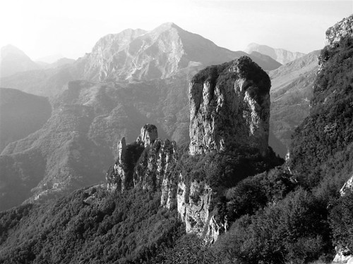
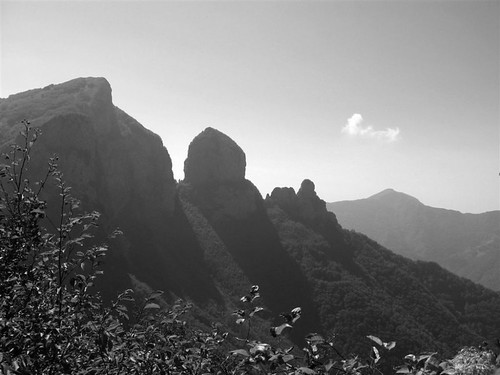
The weather forecast had promised three good days before bad weather arrived, so the via ferrata routes had to be done at the start. The next day we headed to a car park near one of the highest buildings in the area. This allowed us to avoid a significant ascent at the start. The route took us up to the pass, Calare Mattanna, from where strips of red and white paint indicated our route down from the pass, starting with an interesting scramble followed by a slow descent to a path past the base of the main face of Monte Nona. This is the most significant climbing wall in the area, but aside from one rope leading to nowhere in particular in the middle of the face, we couldn’t spot any routes beyond about 6m above us. The path crossed a small footbridge that spanned the chasm between Monte Nona and the ridge that holds the cylindrical Monte Procinto and its smaller, but similarly shaped, neighbours Procinto Bambino and Bambinetta. (Seen below from Monte Forato ) The via ferrata on Procinto is thought to be the first one put up especially for walkers and climbers rather than being left over from World War One.


Monte Procinto
Monte Procinto and its smaller, but similarly shaped, neighbours Procinto
Bambino and Bambinetta (click on any image to view in Flickr)

The base of the via ferrata was located above the path around the base of Procinto and once again it was easier to spot when retracing our steps.


Monte Procinto
Monte Procinto

In the picture above the via ferrata starts near the centre of the rock at the top of the tree line, goes up for half the height, then traverses up and left to enter the obvious cleft. The first section was a ladder followed by a very steep section with footsteps cut into the rock. Ascending a via ferrata involves clipping, using two spring-gate karabiners on slings attached to your harness, to a chain or wire rope at the side of the route. The twin clips ensure that one is always attached whilst passing connection points. The first thing you notice compared to climbing is that you are not ‘safe’ in the case of a fall until you pass the second fixed point on the rope. Another thing is that when you reach the fixing point, the karabiners always have to be dragged up from behind you, so progress is not as quick as you expect. At the top of the steep section was an easy path cut into the rock that led into a cleft in the mountain and a short section of grade two scrambling, made safer by the chain. Above this a path wound its way through the trees to the flat top. Like most Italian mountains, Procinto – at 1177m slightly shorter than Snowdon – has an iron cross at the top. This one showed evidence of many lightning strikes in its life. Whist enjoying a well-earned sandwich we signed the visitor’s book that is stored in a tin on the top. Given its prominent location the views for the top were spectacular, including a better view of the face on Monte Nona and across the Monte Forato ridge, scene of the next days walk (foreground from bottom right in the photograph below), to Pania del Croce. One good thing about walking in this area is that it is nowhere near as busy as the Lake District or Snowdonia. We had met a couple descending the via ferrata as we arrived but other than those, the only people we met all day were two members of the regional mountain rescue team climbing on the far side of Procinto near some small caves and a small group of elderly ramblers when we returned to the pass.


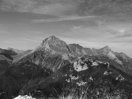
Monte Forato from M Procinto

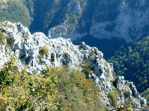
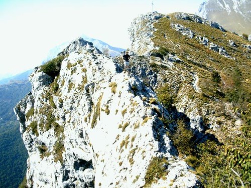
Day three started from the same point but wound around the back of Monte Nona to a pass called Foce di Petrosciana from where it started the climb up the ridge of Monte Forato (foreground in the photograph above). The right side was moderately steep and wooded whilst the left side was mostly a sheer drop, but with fantastic views across the valley. After about 20 minutes we reached the steep section, obviously where the via ferrata started. Once again we spent time wandering back and forth along the lower path, (you can do this route without the via ferrata) trying to find the start, only to find the sign after we’d passed it and again it was more obvious from the ‘wrong’ side. The first section was quite steep, with a few tricky bits and the odd step sideways across the big drop, but the holds were mostly good (my first taste of climbing limestone). Once passed, the slope eased and later became (relatively) level (Pic. 4) and the views even more dramatic


>Monte Forato via ferrata
Monte Forato via ferrata

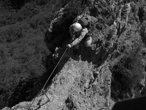
It was also possible to see the sea to the west and the hill town of Barga off to the east. At one point the undulations of the ridge gave Adrian the chance to get high above me and photograph me crossing the narrowest section, with steep drops to both sides.


>Steep drops
Steep drops

For me it was on this section that the via ferrata came into its own as I doubt that I’d have attempted it without the wire. At the end of the ridge the path wandered into the woods and then up to the southern peak which gave us our first sight of Monte Forato’s (‘the pierced mountain’) most significant feature, a rock arch about 40m wide.

Its size and alignment is such that it is visible with binoculars from Barga, over 12km away. After sliding our way down through the woods to the lower path (the real route was not obvious form above) we reached the end of the arch and Adrian sauntered across and back over the 300m drop only to have to go back out again since my camera battery had packed up when he was halfway across (see below)!


>Adrian mid-arch Monte Forato
Adrian mid-arch Monte Forato

We took the lower route back, including an unintended diversion along a spur because of more obscured signs.

After an easy day in and around Lucca, the remainder of the trip was affected by varying amounts of rain. One day involved a drive along great mountain roads though Bagna di Lucca (Lucca Spa) and some high villages. On the final day we drove to the northern end of the Apuane region. There the peaks are higher and more rugged but unfortunately, although the weather low down was reasonable, all the peaks were in cloud. Still, it leaves more for next time!

Kearton